


Aumont Au nasbinal montgros

BELLETGE
User

Length
23 km

Max alt
1257 m

Uphill gradient
488 m
Km-Effort
29 km

Min alt
1022 m

Downhill gradient
330 m
Boucle
No
Creation date :
2021-05-23 06:26:04.272
Updated on :
2021-05-24 16:19:55.985
5h49
Difficulty : Easy

FREE GPS app for hiking
 SityTrail
IGN / Geographical institutes
SityTrail Plus
The world is yours!
About
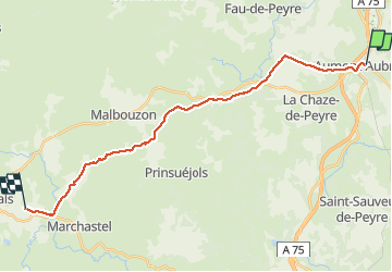
Trail Walking of 23 km to be discovered at Occitania, Lozère, Peyre en Aubrac. This trail is proposed by BELLETGE.
Positioning
Country:
France
Region :
Occitania
Department/Province :
Lozère
Municipality :
Peyre en Aubrac
Location:
Aumont-Aubrac
Start:(Dec)
Start:(UTM)
522764 ; 4952191 (31T) N.
Comments